3

Bigali

Bigali https://ngatapuwae.govt.nz/bigali This typical Ottoman residence is where Mustafa Kemal, later known as Atatürk, made his headquarters during the Allied invasion. Ngā Tapuwae Trails /sites/default/files/stop/media/05%20the%20defence%402x.jpg

This typical Ottoman residence is where Mustafa Kemal, later known as Atatürk, made his headquarters during the Allied invasion. 

GALL_Zone5_Loc_Turkish_Bigali_48k24b.mp3
Read this story

Bigali 

This is the house which Mustafa Kemal used as his Ottoman headquarters. He actually shared the house with the man who was the administrative head of the village, and his family. This was probably the most suitable house for headquarters in the village as it a two-storied stone house. 

There was enough room for military staff, an office for Mustafa Kemal, as well as for the family who lived here. Kemal would occasionally come here for a rest when the campaign fighting was not too fierce. This is a typical Ottoman residence. It is a stone house with a garden, and was built to last for two or three hundred years. 

This house, now a museum, was renovated in the 1970s. There are some photographs inside that relate to the Gallipoli campaign. In the garden are some photos and drawings showing the landing at Anzac Cove, and some of Atatürk’s personal photos.

The garden is a typical Turkish garden with mulberry bushes, and pomegranate, plum, and almond trees, and a well. There is a huge storage jar, which would usually be used for olive oil. This is a beautiful place for a busy and important officer of the Ottoman army to come to and have a rest. People in the village said that in 1915, though some stray shells hit this ground, it was not heavily bombarded. 
The village of Bigali is where the reserve division under Mustafa Kemal, was based. It was deliberately located right in the middle of the peninsula so it was close to both Gaba Tepe and Cape Helles and the soldiers could be easily shipped north to the neck area at Bolyair. Bigali is also very close to Khilia and Eceabat, which were the harbours from where troops would be shipped to the Asian side of Turkey in the event of battles occurring there. 

Another Ottoman reserve regiment was located at Maltepe, which was the Anzac’s final objective. Another regiment was located on the road to Constantinople, now Istanbul – near the Dardanelles.

The men lived in tents. When the Allies flew a reconnaissance to see how many men were in reserve, they simply counted the tents then multiplied the number by nine, as there were nine soldiers to a tent. The number they came up with was 12,000 men. 

Not much has changed in Bigali since 1915. The stone houses here have been recently renovated but the very old minaret remains. Recently there was an earthquake registering 6.5 on the Richter scale, but the minaret was undamaged, unlike others. Maybe the stone masons who built this strong minaret were more skilful than those who built the ones that fell down. 

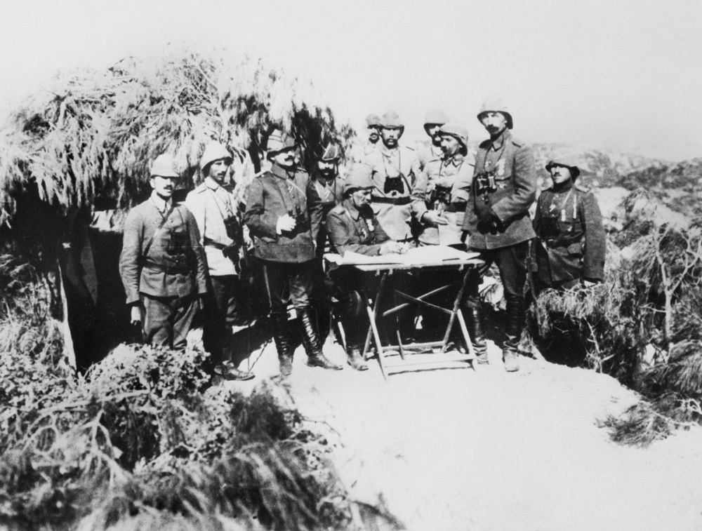
General von Sanders the German commander of the Ottoman 5th Army had his headquarters on the slopes of a nearby hill. Von Sanders is often pictured in history books standing in an area covered by trees and camouflage, which would have been taken in this area.

 A 15-inch shell fired from the Queen Elizabeth landed here but it didn’t explode. It was taken to Constantinople and put in the town square to show locals what the English ships were firing at us at Gallipoli.

According to locals, once when Kemal came to Bigali, he called village goatherds and hunters to come and see him. They didn’t understand why they were summoned, but Kemal’s objective was to learn more about the local terrain, which could help him with his military strategy. There were many animals, especially goats, in this area, and it was only covered with low scrub. Today, it’s a national park, so a lot of trees have grown.

Before 1915, the lifestyle in Bigali was quiet. People only worked on their farms for three months then there was nine months of no work.
How to get here

Getting there

From Anafarta Cemetery follow the paved road through Büyükanafarta, passing the Anafarta/Suvla War Museum on your right and then passing through the village square. Continue on along the road after it leaves the village, taking the right hand turn when the forks after 400 metres. 

Drive another four kms till you see the village of Bigali on your left. Follow the road as it loops around the village to the east, taking the second paved road on your left to enter Bigali. Drive 300 metres till you come to a small parking area to the side of the village square. Park and walk up the side road to the right leading to the square.

Take the narrow road at the left corner of the square past the village tea house on the right and walk 100 metres. On the right is an old village house, used by Mustafa Kemal during the campaign and which now serves as a museum.

Where to stand

Ener the courtyard of the house.

GPS
40°14'10"N
26°21'34"E
Decimal GPS
40.23637
26.3596
  • Essad Pasha, corps commander of the Turkish forces, holds a conference with his staff on a hill overlooking the battlefields.
    Essad Pasha, corps commander of the Turkish forces, holds a conference with his staff on a hill overlooking the battlefields.Credits

    Australian War Memorial A05295 http://www.awm.gov.au/collection/A05295/

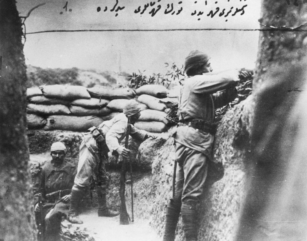
  • Three Turkish soldiers in a trench overlooking Australian positions. One of the men is sitting (left) while the other two men appear to be on the lookout.
    Three Turkish soldiers in a trench overlooking Australian positions. One of the men is sitting (left) while the other two men appear to be on the lookout.Credits

    Australian War Memorial A05299 http://www.awm.gov.au/collection/A05299/

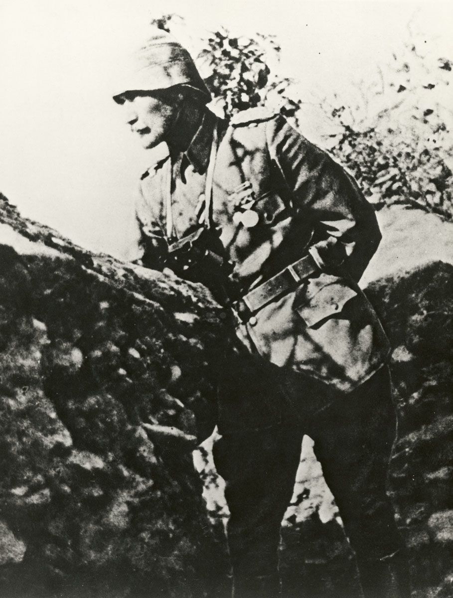
  • Mustafa Kemal (Ataturk) in 1915. He went on to become the First President of the Republic of Turkey.
    Mustafa Kemal (Ataturk) in 1915. He went on to become the First President of the Republic of Turkey.Credits

    Australian War Memorial A05319 http://www.awm.gov.au/collection/A05319/

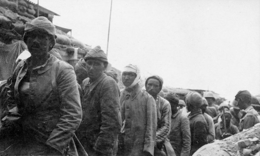
  • Turkish prisoners of war on Anzac Cove beach under supervision of Australian Army soldiers.
    Turkish prisoners of war on Anzac Cove beach under supervision of Australian Army soldiers.Credits

    Australian War Memorial H12548T http://www.awm.gov.au/collection/H12548T/

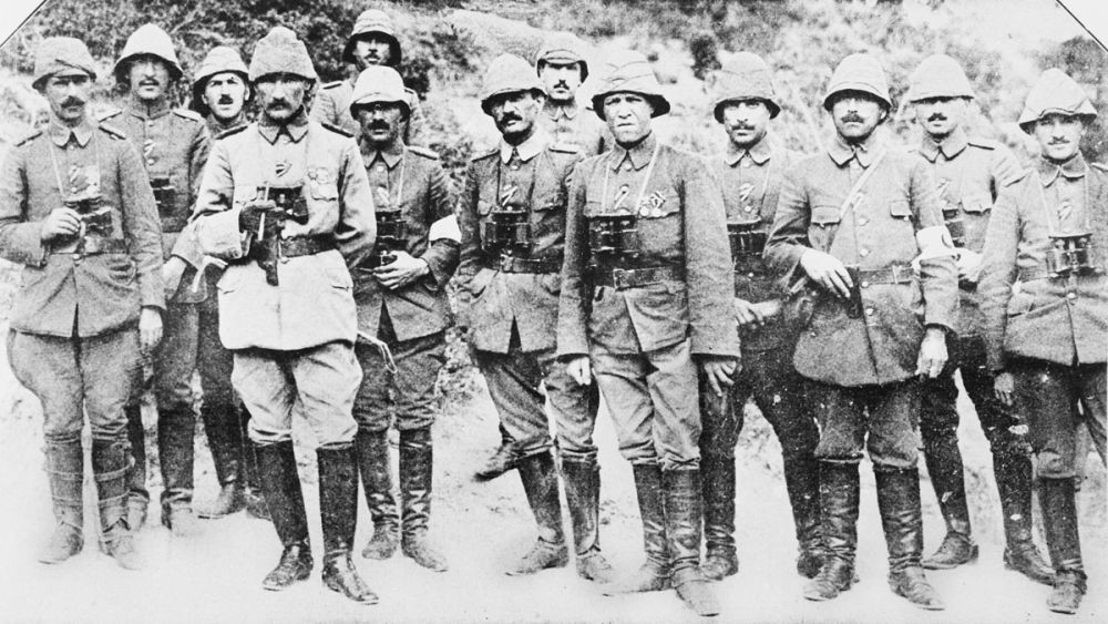
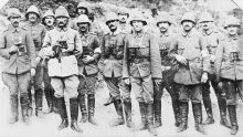
  • Commander Mustafa Kemal (Ataturk) is fourth from the left. He is standing with the officers and staff of his Anafarta group.
    Commander Mustafa Kemal (Ataturk) is fourth from the left. He is standing with the officers and staff of his Anafarta group.Credits

    Australian War memorial P01141.001 http://www.awm.gov.au/collection/P01141.001/

Stories & Insights

Grant was a chaplain at Gallipoli, who frequently braved enemy fire to attend to the men.

A cemetery on the Gallipoli peninsula circa 1918

It broke the evacuating soldiers' hearts to leave dead friends, and they were determined to honour them.

A last farewell to his mates.

For the remaining Anzacs, exposed in their trenches, a stormy winter was the last straw.

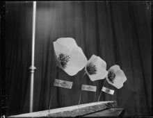
Artificial poppies for sale for Anzac Day photographed circa 23 April 1951

New Zealanders demanded a way to remember - so the first Anzac Day was held in 1916.

Commander Mustafa Kemal (Ataturk) is fourth from the left. He is standing with the officers and staff of his Anafarta group.

From the Ottoman defence forces emerged Atatürk who, after the war, would spearhead the birth of the Turkish republic.

Twisleton was one of 400 sick, exhausted New Zealanders who took part in the Battle for Hill 60.

Powles and his regiment were some of the last to leave Gallipoli – they were among the ‘diehards’.

Take the next trail

The next Ngā Tapuwae trail is Cape Helles. Proceed to Kilitbahir.
Link to the first stop

Decimal GPS:
40.27272
26.29299
Sequence:
1
Decimal GPS:
40.28297
26.32337
Sequence:
2
Decimal GPS:
40.23637
26.3596
Sequence:
3

Stop Images

Sequence:
1
Decimal GPS Real Location:
40.27272
26.29299
Sequence:
2
Decimal GPS Real Location:
40.28297
26.32337
Sequence:
3
Decimal GPS Real Location:
40.23637
26.3596