New Zealand Memorial
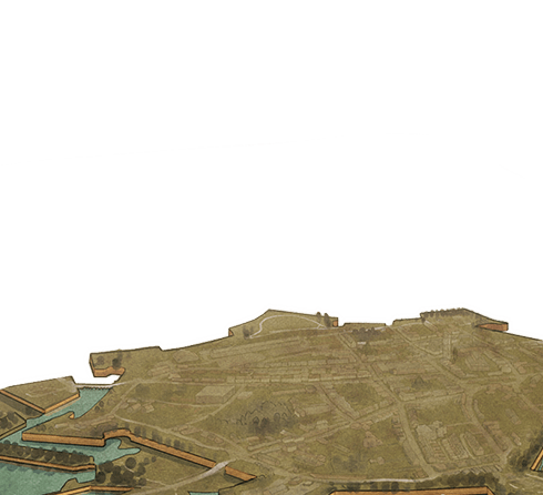
You’re standing next to the inner ramparts of the fortress of Le Quesnoy - a brilliant Vauban fortification of the 17th century. 1918 was a year of outstanding success for the New Zealand Division - it started with them successfully holding the line against the German advance on Amiens at Mailly-Maillet. They then took Rossignol Wood and then kept advancing forward - to where you are now. As 2nd Lieutenant Richards described it, it was like a series of waves lapping forward, being momentarily held by the Germans, and then lapping forward again, with the New Zealand Division spearheading the advance.
By this stage, Russell was confident that his three infantry brigades with their artillery, tanks and support from cavalry including the Otago Mounted Rifles, could deal with anything that they faced. The attack on Bapaume was followed by the taking of the Trescault spur, the advance to Crvecœur, and then Solesmes. Now the object was to bypass Le Quesnoy and advance to the next river line and seize a crossing Russell’s intention was to use his weakest brigade, the New Zealand Rifle Brigade, to surround Le Quesnoy. He was conscious of the civilian population. And he didn’t want to bombard the town itself, but he fired mortars and machine guns on top of the ramparts to mask his advance.
A special British mortar-detachment fired drums of oil that exploded in fire and smoke shielding New Zealand movement from the German defenders.
Immediately after the commencement of the artillery fire a sheet of flame rushed skywards from behind the waiting troops, and following a pause during which a mighty rushing noise seemed to drown all other sounds, huge flames burst from hundreds of points beyond the railway and about the outworks of the town. This was the special burning-oil bombardment which, though it resulted in little material damage to the enemy's position or to his men, had, nevertheless, a most important moral effect on both attackers and defenders.
Lieutenant-Colonel William Austin
Russell’s plan bypassed the German infantry who fell back into the town. The New Zealanders also captured all of the German artillery, which being short of horses, were grouped together, and some 57 guns were taken. The New Zealanders now pushed past the town heading towards the next river line. Meanwhile the 4th Rifle Battalion led by Lieutenant-Colonel Barrowclough, pushed through the outer defences up to this city wall. All around the town, the other battalions of the Rifle Brigade were doing the same. It became a race. They were not supposed to attack the town, but everyone wanted to be the first in. Barrowclough’s soldiers worked their way forward, with them were New Zealand Engineers, and as Le Quesnoy was an apple growing area, the Engineers had collected ladders from surrounding orchards - because they knew the walls were going to be a problem.
The 30-foot ladder was too short to reach from the bottom of the moat to the top of the final wall but there was one place where the ladder could be placed to reach the top. This was on a narrow stone bridge, about a foot wide, which spanned the moat and was connected with a sluice-gate ... After crossing this bridge and sluice-gate a narrow ledge ran for some 10 yards beside the wall to an arched opening, giving entrance to the town, but which – needless to say – had been completely blocked by the enemy to deny us access through the wall.
2nd-Lieutenant Leslie Averill
This water gate was the only point where the single remaining ladder would reach the top. Unlike the monument that you see in front of you which has about 15 or so guys clinging to the one ladder, the reality was that only one fully equipped soldier could go up at a time - any more men on the ladder, and it would break, with them all tumbling down.
They set the ladder up on the dam leading to the watergate and 2nd Lieutenant Averill, pistol in hand, went up first. A few more men followed him up and when they were at the top, Averill looked down, saw a couple of Germans, and fired at them - and they vanished into the town. Averill lead a half dozen New Zealanders forward, and if you read the New York Times and the world press in 1918, you would hear all about the New Zealanders fighting their way over the walls of Le Quesnoy - but nothing like that happened. The battle was getting to the wall, and once Averill got to the top - word spread like wildfire.
..as we reached the top of the fortress wall. The whole town lay at our feet and it was easy to direct each platoon or company to move down particular streets which could readily be pointed out from where I stood on the rampart wall… From where I stood I could watch their progress along each street. As they went along the “tricolours” began to appear from the windows of the houses and the inhabitants poured out into the streets and what a welcome we received from them all!
Lieutenant-Colonel Barrowclough
On the other side of the town, Captain Lindsay Inglis commented that his battalion would have made it in first - if it wasn’t for the locals plying them with apple brandy and too warm a welcome. Le Quesnoy had fallen, and the story of storming the walls passed into history and legend.
But, for Russell, the key part of this battle was the fact that his leading brigade pushed on through the forest of Mormal, to secure the next river crossing. This advance was the final battle of the New Zealand Division and it was an outstanding success.


 at the dedication ceremony for the New Zealand memorial at Le Quesnoy, France, 1923.")