3

Gare d’Arras

Gare d’Arras https://ngatapuwae.govt.nz/gare-darras This is where the New Zealand Tunnelling Company based its headquarters. Ngā Tapuwae Trails /sites/default/files/stop/media/Western%20Front-Arras-Gare%20d%27Arras-Alexander%20Turnbull%20Library-12-013373-G.jpg

This is where the New Zealand Tunnelling Company based its headquarters.

WF_Arras_Loc_GareD_Arras_20150826.mp3
Read this story

Gare d’Arras

You’re standing in the station square of the Gare d’Arras by the war memorial. Arras was first fortified in the 13th century, and later, the city defences, were constructed by Vauban - the foremost engineer of his time - in the 17th century. This area was the traditional route of invading armies, either attacking out of or attacking into France - and so there was a whole network of fortified towns to protect the frontiers. Ypres played a similar role in Flanders. In the late 19th century the city knocked down the walls and covered over the moat, which then became part of an underground sewer-system. Here where you stand stood the walls and this became the route of the Arras railway line because it offered up a superb site, right through the centre of the city. The underground sewer runs under the railway line in front of where you are standing. Like Ypres, Arras became an important salient during the First World War. The outer suburbs became the frontline area and right here was where the New Zealand tunnellers, connected the sewer system to specially built tunnels, underneath the two main roads. The basement of the post office, behind you just a block away down the street, was the site of the New Zealand Tunnelling Company Headquarters.

As the buildings around you were destroyed by shelling, the New Zealand Tunnellers recce’d the cellars to find accommodation for soldiers. Exploring underground, they found that the former moat linked up with the Crinchon sewer that led from this square back, into the centre of town. Surrounding the Hôtel de Ville are the Grand’ and Petite Place. Today, many of the restaurants are situated in the basements of those two squares. You can pop down and look at the back walls - maybe ask the owner first - and you’ll see a change in stone work or an obvious place that’s been bricked up. That’s where the New Zealand Tunnellers knocked their way through the back of the basement to find the link into the sewer - so that the soldiers living in that basement could then be transported down through the sewer system. They then linked up with the tunnels that the New Zealanders had dug under the line of the two main roads. On your right is the overbridge leading to Bapaume, the tunnel dug under this linked up with the seven big caverns that the New Zealanders turned into an underground city for over 12,000 men.

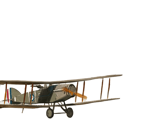
So here, in Arras, an entire underground city was created by many skilled and brave miners, and this enabled thousands of Allied troops to live fairly comfortably underground, with protection from the war, above. This network of tunnels also provided a safe way to transport troops directly to the front line, a secretive route that was a complete surprise to the Germans, in the Arras offensive of April 1917.

How to get here

Getting there

Go back the way you came on Boulevard du Général de Gaulle and continue along Boulevard Vauban. Boulevard Vauban turns slightly right and becomes Boulevard Carnot.

Keep going until you see the Gare d’Arras straight ahead of you.

Where to stand

Walk up to the war memorial in the Arras station square and face the same way as the French soldier.

GPS
50°17'14"N
2°46'50"E
Decimal GPS
50.2873
2.780698
  • Men of the New Zealand Tunnelling Company a road near Arras, France, 17 July, 1918.
    Men of the New Zealand Tunnelling Company a road near Arras, France, 17 July, 1918.Credits

    Alexander Turnbull Library, Wellington. Ref: 1/2-013373-G. http://natlib.govt.nz/records/22322435

  • The railway station at Arras after a series of German bombardments. 1914.
    The railway station at Arras after a series of German bombardments. 1914. Credits

    Australian War Memorial Museum H11782 (CC BY-NC 3.0 AU)

  • An etching by Stefano Della Bella. Plan et vue de la ville d'Arras
    An etching by Stefano Della Bella. Plan et vue de la ville d'ArrasCredits

    Mackelvie Trust Collection, Auckland Art Gallery Toi o Tāmaki, bequest of Dr Walter Auburn, 1982, M1982/1/1/87

  • Portrait of Sebastien le Prestre de Vauban (1633-1707)
    Portrait of Sebastien le Prestre de Vauban (1633-1707)Credits

    Public Domain

  • The Town Hall of Arras in ruins, May 1917.
    The Town Hall of Arras in ruins, May 1917.Credits

    © Imperial War Museums (Q 2049)

Stories & Insights

Despite being rejected three times, Williamson was determined to join the war effort.

Members of the Maori Pioneer Battalion pose inside an aeroplane.

Aeroplanes began as reconnaissance craft but quickly evolved to include bombers and fighters as the war in the sky escalated.

A soldiers playing with Snowy the cat, the New Zealand Tunnellers' mascot, in Dainville, France.

The first to arrive on the Western Front, the tunnellers were among the last to leave.

When German mines buried British soldiers, Vernon quickly volunteered to free them.

Men of the New Zealand Tunnelling Company below ground at La Fosse Farm, 5 December 1917.

Using picks, shovels and explosives, the miners connected and expanded a huge network of tunnels underground.

After six months’ pilot training, Coates felt completely at home in the air.

Useful resources for those looking for more information.

A selection of First World War vocabulary and common phrases.

Take the next trail

The next Ngā Tapuwae trail is Somme 1916. Proceed to Caterpillar Valley Cemetery.
Link to the first stop

Decimal GPS:
65.70238419370952
-64.67303068749993
Sequence:
1
Decimal GPS:
56.45982490554022
-24.837410249999948
Sequence:
2
Decimal GPS:
59.63169880087988
-65.07086449999997
Sequence:
3

Stop Images

Sequence:
1
Decimal GPS Real Location:
50.28004
2.783024
Sequence:
2
Decimal GPS Real Location:
50.28702
2.760246
Sequence:
3
Decimal GPS Real Location:
50.2873
2.780698