2

Ramparts Cemetery

Ramparts Cemetery https://ngatapuwae.govt.nz/ramparts-cemetery This area was home to the New Zealand Division’s headquarters. Ngā Tapuwae Trails /sites/default/files/stop/media/Western%20Front-Behind%20the%20Lines-Ramparts-Alexander%20Turnbull%20Library-1-2-013793-G.jpg

This area was home to the New Zealand Division’s headquarters.

WF_Ypres_Loc_RampartsCemetery_201509.mp3
Read this story

Ramparts Cemetery

You’re standing in Ramparts Cemetery, by the grave of Lance Corporal Snodgrass of the New Zealand Engineers, who was killed in December 1917.

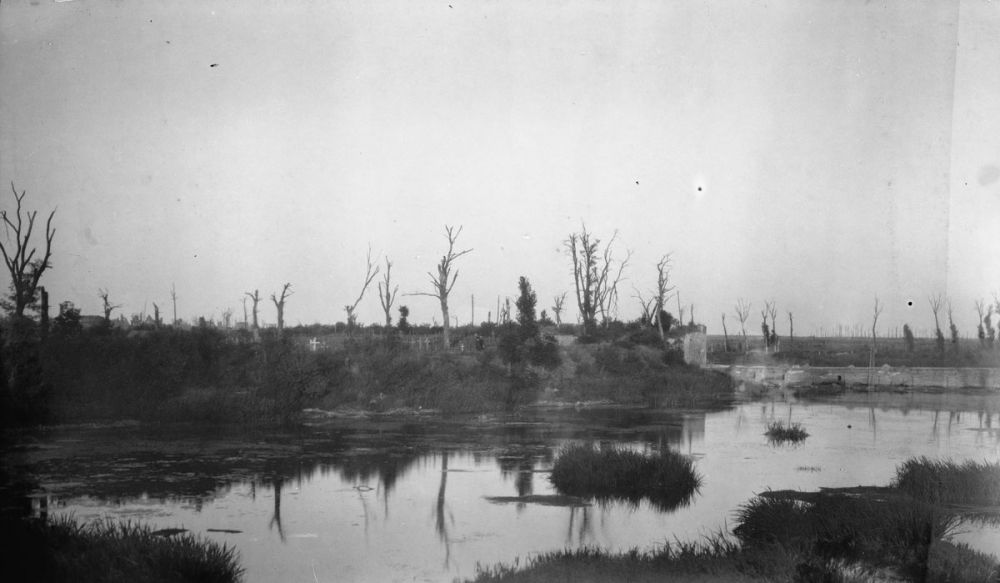
You’re by the moat of the city of Ypres, which - through the ages - has been a fortress blocking advances down the coastal plain of Europe, towards France. This was a traditional route for warring armies over the centuries, and has seen rule under the French and Spanish. The fortress complex was further developed by Vauban, and completed near the end of the 17th century.

In 1914, after much fighting, this was where the French and the British stopped the German advance, and the Germans dug in on the ridges surrounding Ypres. The combination of the Fortress of Ypres, the military canal that heads north, and - in front of you and to your right - that low ring of hills centred on Passchendaele - was of enormous strategic significance. Battles were fought here for the next four years - with the British determined to hold on.

Then, in 1917, they were determined to break out - and push the Germans back. The Menin Gate further around these ramparts heads directly east, towards the nearby small town of Menin. During the war it also faced the German frontlines - so it was under constant artillery fire and observation from the Germans, who held the surrounding high ground. The Lille Gate, which is to your right, wasn’t facing the frontline and provided some cover from the constant shelling. This was where the New Zealand supplies and reinforcements marched across that bridge, around up the roads, into the communication trenches, and then on into the frontline.

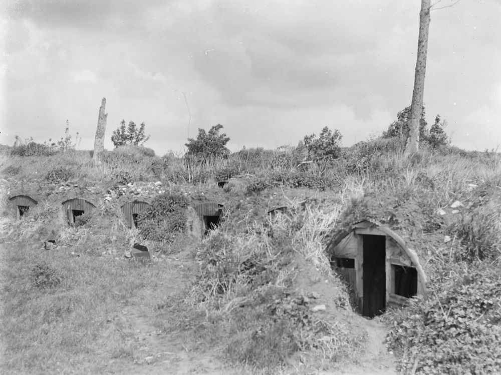
In December 1917, the New Zealanders were holding the Polygon Wood sector, which is out through Hellfire Corner on your right. Making sure that this road stayed open, while the German artillery fired on it every night, were people like Corporal Snodgrass, and the engineers and pioneers of the Māori Pioneer Battalion. Each night they would work on the road under constant fire. They actually lived under the men they buried because, down underneath these ramparts, they tunnelled in dugouts or used the existing casemates that had been built when Vauban turned this into a fortress. Under here was their home - their shelter.

In these ramparts were also the New Zealand Division’s headquarters. So this part of Ypres was both the communications centre and the directing centre for the battle that was being waged along the frontline at Polygon Wood. It was also where engineers and pioneers worked, and they kept the road open to ensure that the supplies went forward, and the casualties came back - and they are buried in the cemetery all around you. This was the cost.

How to get here

Getting there

Ramparts Cemetery is an easy half-hour walk from the southern side of the Menin Gate along a well signposted path following the moat and ramparts of Ypres.

Where to stand

Enter Ramparts Cemetery, turn right and walk to the row of graves furthest from the entrance. Stand at the grave of Lance Corporal Snodgrass and turn to face the water.

GPS
50°50'40"N
2°53'19"E
Decimal GPS
50.84468
2.888852
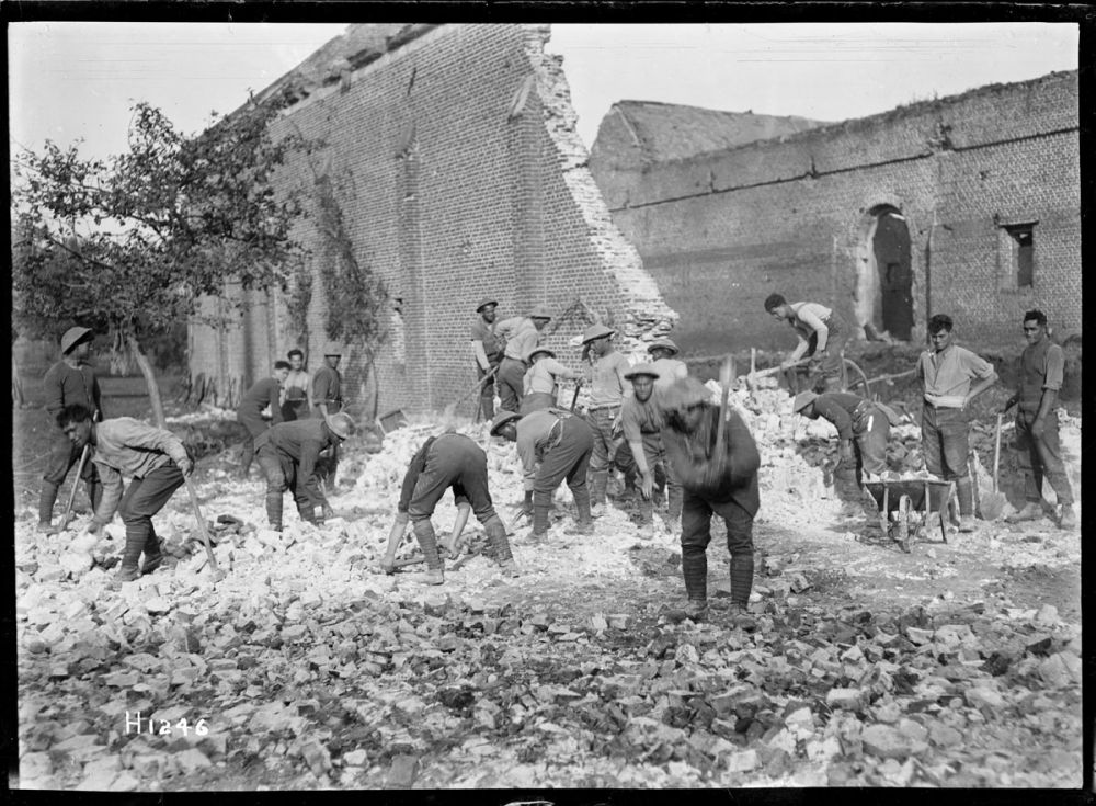
  • Men from the New Zealand Pioneer Battalion make a road through damaged buildings, France 1918.
    Men from the New Zealand Pioneer Battalion make a road through damaged buildings, France 1918.Credits

    Alexander Turnbull Library, Wellington. Ref: 1/2-013793-G. http://natlib.govt.nz/records/22690164

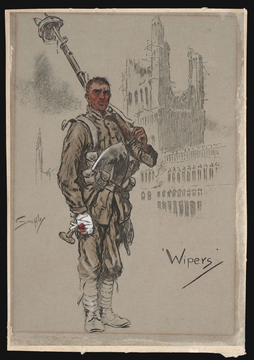
  • A hand coloured lithograph showing a soldier with a bandaged hand, with what appears to be the ruins of Cloth Hall in the background.
    A hand coloured lithograph showing a soldier with a bandaged hand, with what appears to be the ruins of Cloth Hall in the background.Credits

    Alexander Turnbull Library, Wellington. Ref: A-184-059. http://natlib.govt.nz/records/22752333

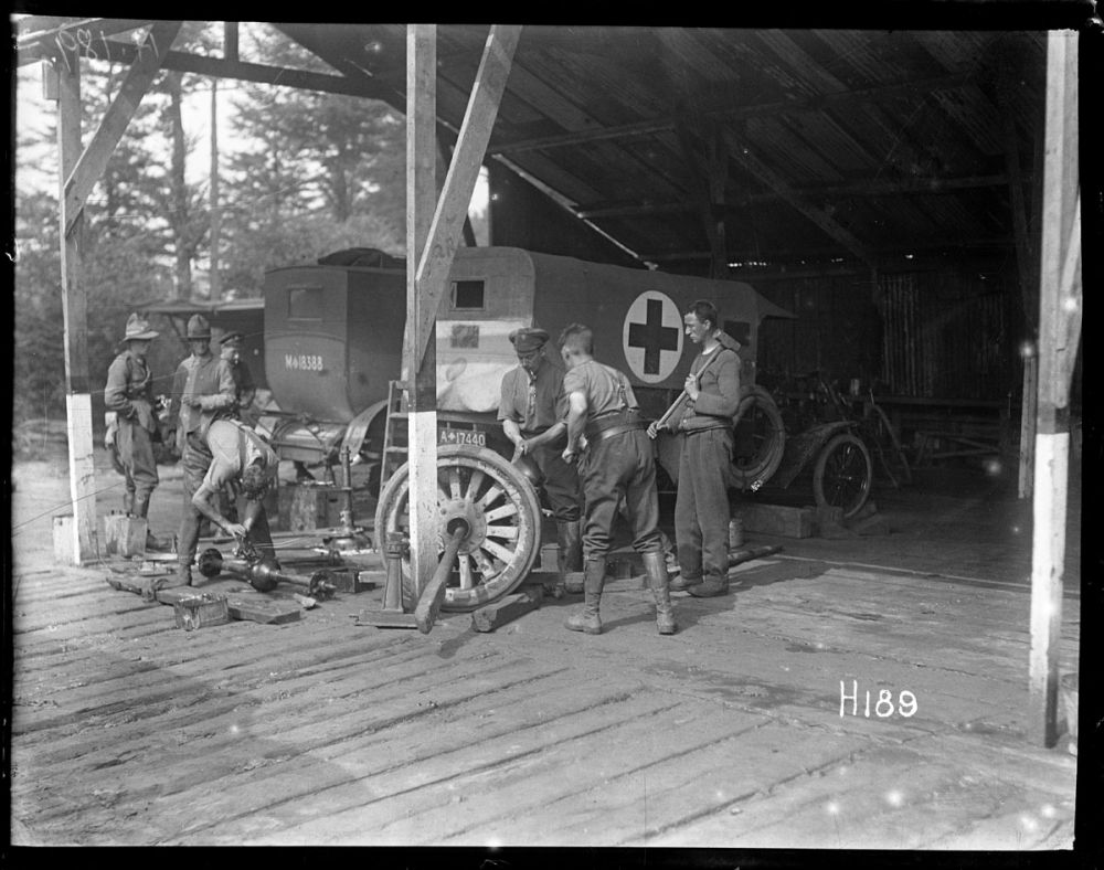
  • New Zealand Engineers Engineers from a supply column repair a vehicle on the Western Front.
    New Zealand Engineers Engineers from a supply column repair a vehicle on the Western Front.Credits

    Defence Force Library

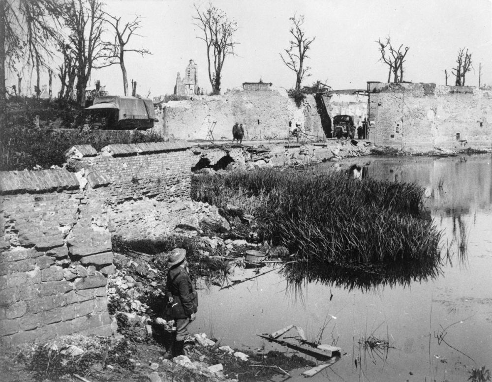
  • The shattered ramparts of Lille Gate and the St. Eloi Road from across the maot. Ypres, September 1917.
    The shattered ramparts of Lille Gate and the St. Eloi Road from across the maot. Ypres, September 1917.Credits

    © Imperial War Museums (Q 11701)

  • Dug-outs built into hills, Ypres.
    Dug-outs built into hills, Ypres.Credits

    © Imperial War Museums (Q 37268)

  • A view of the moat, ramparts and cemetery at Lille Gate, Ypres.
    A view of the moat, ramparts and cemetery at Lille Gate, Ypres.Credits

    © Jeremy Gordon-Smith (Q 100365)

Stories & Insights

As a conscientious objector, Briggs refused to serve the army at home or abroad.

An eager medical student, Currie got a lot of practice in the field.

For his bravery and devotion to duty, Rogers was awarded the Military Cross.

Soldiers walk among the ruins in the town of Ypres, Belgium, 1917.

The main centre of conflict since 1914, the Ypres Salient was defended by the British and home to three major battles throughout the war.

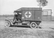
A New Zealand Division ambulance with shrapnel-proofing at a casualty clearing station near Albert. September 1916.

Due to the rising number of casualties, a highly efficient system of medical treatment centres and transport was established.

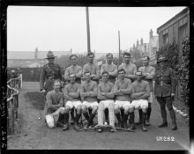
New Zealand soldiers pose

Vital to soldier's wellbeing was time away from the front, where men could rest, play sport, read, and write letters.

Useful resources for those looking for more information.

A selection of First World War vocabulary and common phrases.

Take the next trail

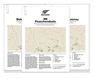
The next Ngā Tapuwae trail is Passchendaele. Proceed to Dochy Farm.
Link to the first stop

Decimal GPS:
73.16606927809583
-102.07452690624996
Sequence:
1
Decimal GPS:
73.1912090133783
-98.16339409374996
Sequence:
2
Decimal GPS:
50.740402392562665
-106.52911221875002
Sequence:
3
Decimal GPS:
67.09203121498165
-22.085719562500003
Sequence:
4

Stop Images

Sequence:
1
Decimal GPS Real Location:
50.85202
2.891078
Sequence:
2
Decimal GPS Real Location:
50.84468
2.888852
Sequence:
3
Decimal GPS Real Location:
50.85025
2.696962
Sequence:
4
Decimal GPS Real Location:
50.73815
2.743382