4

Wolf Farm

Wolf Farm https://ngatapuwae.govt.nz/wolf-farm This is as far as the New Zealanders got on 12 October 1917. Ngā Tapuwae Trails /sites/default/files/stop/media/Western%20Front-Passchendaele-Wolf%20Farm-Alexander%20Turnbull%20Library-12-012933-G.jpg

This is as far as the New Zealanders got on 12 October 1917.

WF_Passchendaele_Loc_WolfFarm_201509.mp3
Read this story

Wolf Farm

This was the furtherest point reached by the New Zealand Rifle Brigade in the attack on 12 October 1917. In front of you to your right is Wolf Farm, and Bellevue Spur is the sloping high ground in the distance. Bellevue Spur was the initial New Zealand objective on 12 October and if you follow this spur along the skyline, you can see the spire of the village of Passendale which was the final objective for Godley’s 2nd Anzac Corps.

On the slope itself, in fact in this area around you, none of these houses or trees still stood but all of the farm house cellars had been converted into German strongpoints, manned by machine guns and snipers. The only evidence left of a farm house was usually the red of the mud where the brick dust had mixed in with the earth. Looking back behind you, the start line on this flank for the attack was the farmhouse complex on the skyline - that was the New Zealand startline - and all of this land around you was covered in craters and mud.

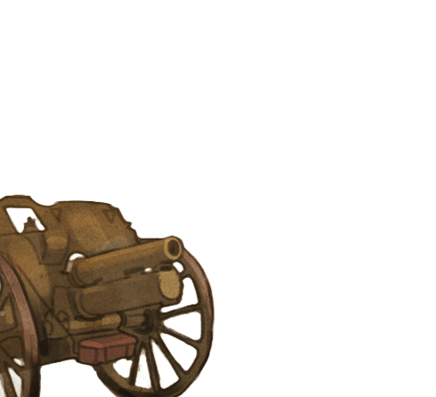
If you can imagine German defenders in their bunkers during the artillery bombardment once they knew the attack was actually happening - they would quickly set up their machine guns on top or next to their bunkers. The Germans would see long single files of infantry, wading their way, forward in the mud, and as their machine guns opened up they would force entire battalions to the ground.

On the morning of 12 October the New Zealand Rifle Brigade started pushing forward to this point - they suffered many casualties. Finally a mix of all three battalions of the Rifle Brigade reached the general line of the road, seizing this piece of high ground. They then tried to push forward, in the direction towards Wolf Farm and onto Bellevue Spur, but this failed. Some fought their way down into Wolf Farm, taking out bunkers - but barbed wire stopped them getting any further. Today, if you walked up there, it would only take you 15 minutes. In 1917 - the reality was hours of crawling and wading through mud and water, against artillery, machine gun and rifle fire. But here is where they were stopped.

They were defeated by the flooded stream, the mud, and the uncut wire, and they could go no further.

How to get here

Getting there

Follow the road ('s Graventafelstraat) for about 500 metres and turn left at the brick tower on to Ravestraat. After about 600 metres the road forks, take the right hand fork onto Wallemolenstraat. 

Where to stand

Find a park just before the right-hand turnoff to Passendale near the cluster of houses. Walk back the way you came along the road until you reach the first farmhouse.

Stand on the left-hand side of the road facing across the road. Make sure you don't go past the house, so it doesn’t obscure your view.

GPS
50°54'11"N
2°59'11"E
Decimal GPS
50.90308
2.98641
  • New Zealand reinforcements moving up to the front, near Kansas Farm in the Ypres Salient. 13 October, 1917.
    New Zealand reinforcements moving up to the front, near Kansas Farm in the Ypres Salient. 13 October, 1917.Credits

    Alexander Turnbull Library, Wellington. Ref: 1/2-012933-G


  • New Zealand soldiers in the ruins of the 'Capitol', which briefly became the New Zealand Division's headquarters.
    New Zealand soldiers in the ruins of the 'Capitol', which briefly became the New Zealand Division's headquarters.Credits

    Alexander Turnbull Library, Wellington. Ref: 1/2-012927-G

  • A New Zealand signaller operates on a destroyed German bunker at Gallipoli Farm, Belgium, 12 October 1917.
    A New Zealand signaller operates on a destroyed German bunker at Gallipoli Farm, Belgium, 12 October 1917.Credits

    Alexander Turnbull Library, Wellington. Ref: 1/2-012945-G. http://natlib.govt.nz/records/23173278

  • The swamp-like conditions of Zonnebeke during the battle of Passchendaele, 1917. The ruins of the Zonnebeke Church can be seen in the background.
    The swamp-like conditions of Zonnebeke during the battle of Passchendaele, 1917. The ruins of the Zonnebeke Church can be seen in the background. Credits

    Auckland War Memorial Museum E01200 (CC BY-NC 3.0 AU)

  •  A map of trenches at Passchendaele, showing Wolf Copse, Woodland Plantation, Bellevue, Waterloo. 17 October 1917.
    A map of trenches at Passchendaele, showing Wolf Copse, Woodland Plantation, Bellevue, Waterloo. 17 October 1917.Credits

    © Imperial War Museums (Q 64330)

Stories & Insights

Armed with Lewis Guns and grenades, Ingram and his team faced German pillboxes and machine guns.

New Zealand Engineers resting in a large shell crater at Spree Farm, Ypres Salient, 12 October 1917.

Rain, mud and heavy artillery churned up the earth and made everything seem impossible, but the war continued.

Aerial view, somewhere over the Ypres Salient, showing the pock-marked earth, riddled with shell craters, and the remains of several trenches.

Messines was a staggering success for the Allies, yet Passchendaele was a total disaster. What went wrong?

Knight was newly promoted and led his men towards the enemy defences at Bellevue Spur.

Men at advanced dressing station, prepare a wounded soldier for the ambulance at Somme Farm, Ypres Salient.

At first, the failed attack was mildly described as 'another blow' - but New Zealand's darkest day had further and longer lasting consequences.

Hart was right in the thick of the action, facing formidable German defences at Passchendaele.

Useful resources for those looking for more information.

A selection of First World War vocabulary and common phrases.

Take the next trail

The next Ngā Tapuwae trail is Polygon Wood. Proceed to Buttes New British Cemetery.
Link to the first stop

Decimal GPS:
58.51905446777189
-64.37448140624997
Sequence:
1
Decimal GPS:
66.72043815745349
-84.27422796874993
Sequence:
2
Decimal GPS:
69.04523261367216
-77.14705334375003
Sequence:
3
Decimal GPS:
70.87108082572053
-102.54825796875008
Sequence:
4
Decimal GPS:
70.67047442190707
-35.803109937500096
Sequence:
5

Stop Images

Sequence:
1
Decimal GPS Real Location:
50.88187
2.97171
Sequence:
2
Decimal GPS Real Location:
50.8907
2.97919
Sequence:
3
Decimal GPS Real Location:
50.89307
2.987224
Sequence:
4
Decimal GPS Real Location:
50.90308
2.98641
Sequence:
5
Decimal GPS Real Location:
50.88744
3.000601