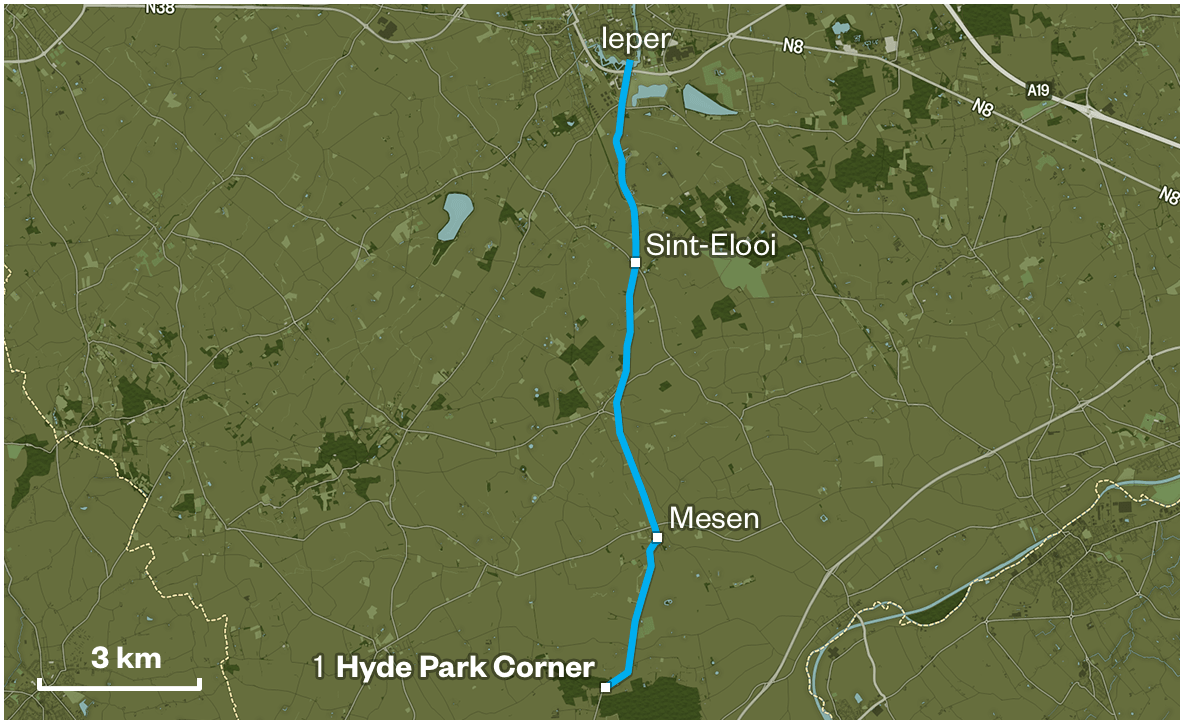
Hyde Park Corner
You are standing at Hyde Park Corner. Hyde Park Corner is the junction of the Messines-Ploegsteert Road - or Plugstreet as the British called it, and it’s in the sheltered side of Hill 63. Messines is just beyond this hill and it would be the first major battle for the New Zealand Division in 1917. The road continues south through Ploegsteert to the industrial centre of Armentières which is just across the border in France.
Apart from during the New Zealand involvement in the Battle of the Somme this general area was the New Zealanders’ home for all of 1916 and most of 1917. New Zealand was a new division and this was regarded as a nursery sector. It was where new divisions were blooded and learnt the rules of trench warfare on the Western Front. The ground was low-lying and prone to flooding, and so trenches were built up above ground with huge piles of sandbags.
It was a static war - of sniping, artillery and mortar fire. All the work was done at night, including trench improvements, wiring parties in no-man’s land and raids by observation and fighting patrols from both sides. The aim of a raid was to take prisoners, and to establish the identities and plans of the enemy. It was also an effective method to destabilise the enemy, and to maintain an aggressive mood among the troops.
“In this area the term trench was somewhat of a misnomer; it was impossible to dig very far before encountering water, and the result was that for the most part both parapet and parados consisted of walls built up of sandbags.”
Charles Marsack
This trench warfare was conducted from the Belgian coast to the Swiss border, with the British armies occupying a line stretching from the Ypres Salient to the River Somme. The bulk of the fighting and the majority of the casualties had been suffered by the much larger French Army and there was increasing pressure from the French for the expanding British armies to do a greater share. General Sir Douglas Haig, the British Commander-in-Chief agreed to mount a major British attack in July 1916 as part of a joint offensive where the two armies met in the Somme Valley.
This was a very different war from Gallipoli. When the New Zealand Division first occupied Armentières, there was a large civilian population. When they were in reserve, the New Zealanders were billeted in the town - in disused factories - and could go to the estaminets or cafes in the town and buy egg and chips, and beer and wine. There were shops that sold souvenirs such as lace postcards that the soldiers sent home.
“Beer plus wines are exceedingly cheap - deuxsou - penny per glass plus champagne four, five, six, francs a bottle plus you may be sure that the troops consume, enormous quantities, firstly, on account of the cheapness, secondly on account of the weakness plus thirdly on account of the bad drinking water.”
Robert Shepherd
Armentires was not an easy initiation for the New Zealanders. They were the new boys, and they found out that the German snipers and machine gunners were masters at their trade. The New Zealanders made many mistakes and this cost lives. It was a hard school, and raids by both sides were common. Lieutenant-General Godley’s 2nd ANZAC Corps, along with the rest of the British Army in the northern sector - were ordered to increase patrols and raids so as to stop the German armies sending reinforcements south to the Somme. The New Zealanders came back to this sector after the Somme. From early 1917 through to June of that year, they used this area as a base and assembly area for the attack on Messines.
The Messines-Wytschate Ridge had been held by the Germans since 1914 and it gave good observation for German artillery to fire on the roads leading into Ypres from the west. Haig wanted to break out of the Ypres Salient and needed to take the Messines Ridge as the first step. Preparations included large-scale mining operations both to drive tunnels under the German defences on the ridge, but also to dig accommodation areas into the sides of hills on higher ground.
Here at Hyde Park Corner the 1st Australian Tunnelling Company had dug an underground complex inside this hill in front of you. It was known as the “Catacombs”, and could accommodate up to 1,200 men. This entire hillside was covered in dugouts that could accommodate some 4,500 men, both above and below ground. This is where the reserve brigade was based - while the other New Zealand brigades occupied the front line and support trenches. This was the New Zealanders’ base for operations against Messines. And the attack from 7 to 14 June 1917 was a major victory for General Sir Herbert “Daddy” Plumer’s 2nd Army.
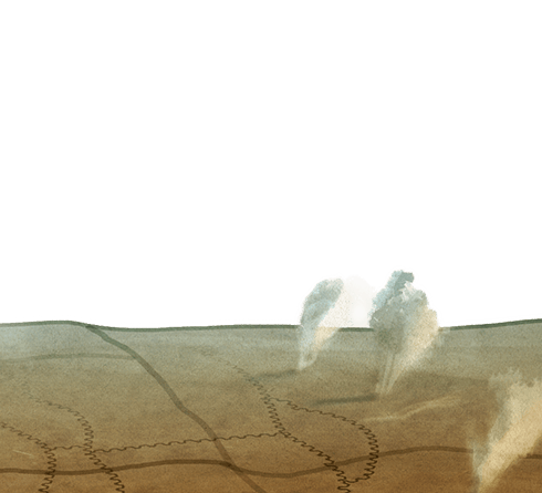
Where you’re standing at Hyde Park Corner was under German artillery and gas shell fire every night, and this was a very dangerous spot. For safety, the New Zealand “Diggers” as they were called, lived underground, and this was the New Zealand Division’s home for seven months in 1917.
The New Zealand “Diggers” were crammed into an underground city of 19 streets, each with barrack rooms with multi-tiered wooden bunks. There was only chicken wire for a mattress, and the soldiers lay there fully clothed, with boots on, with all their kit piled up on the bunk. There were kitchens, toilets, first aid stations, officers quarters, even electric lighting, all under there - and it was stinking, dark, cold and constantly wet, with the water pumps working all the time.
To stop gas creeping in underground, particularly mustard gas, they used to have double-layer canvas entrances, acting like doors. And even though there was air circulation, the fact is, it stank to high heaven of unwashed bodies, dirty socks, and the results of a diet of beef stew. Men bathed every eight to 12 days, and got clean clothes at the same time. Every soldier was lousy and spent his spare time cracking lice and their eggs in the seams of his clothing. Rats were everywhere, and rat hunts were great sport.
“The brutes are in hundreds and as big as cats with tails like kangaroos. Our little cookshop was swarming with mice but one does not mind them so much.”
Robert Brebner
A soldier could never be alone. He lived side by side with the men in his platoon. You ate, slept, and bathed together, you worked, fought, and died together. There was no escape.
After the success of Messines, the major operation undertaken by the New Zealand Division - as part of the 2nd ANZAC Corps - was advancing up to the river Lys, as the Germans pulled back from the Messines sector. Both the Australian and New Zealand divisions followed the Germans as they retreated.
The New Zealanders attacked La Basseville, on 26 July, but were thrown out by the Germans. On the 31st, they attacked again, and held it, despite ferocious German counter-attacks. On the same day, Haig’s 3rd Battle of Ypres, more commonly known to us today as Passchendaele, began.