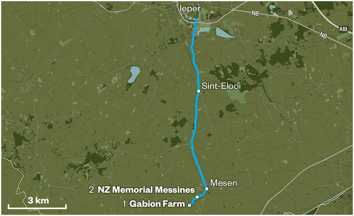
1

Gabion Farm

Gabion Farm https://ngatapuwae.govt.nz/western-front/messines This area became the jump-off point for the New Zealand attack at Messines. Ngā Tapuwae Trails /sites/default/files/stop/media/battlemap_04_messiness.jpg

This area became the jump-off point for the New Zealand attack at Messines.

WF_Messines_Loc_GabionFarm_20150914.mp3
Read this story

Gabion Farm

You are in the valley of the river Douve, in front of Gabion Farm. If you look up to the ridge in front of you, see the houses on the skyline – that’s the village of Messines, or Mesen, as it’s known now. From Messines, through to Wijtschate which is marked by that church spire further along the ridge to your left - is this dominating piece of high ground, which the Germans held from October 1914.

From this position along the Messines-Wijtschate ridge, the Germans could dominate the supply roads coming into the city. This allowed their artillery fire to interfere with any attempt to reinforce Ypres, so if the British wanted to mount a major offensive it was critical that this ridge be taken.

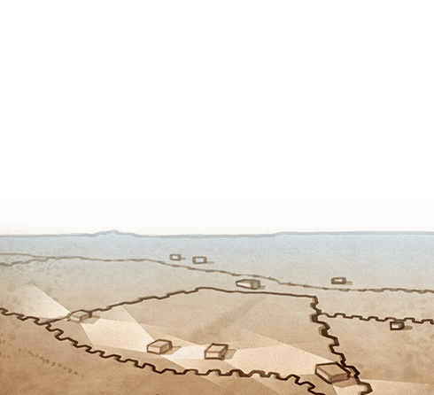
Where you’re standing now was known as Gabion Farm and in front of you - below Messines ridge, is the line of the stream - that was the New Zealand outpost line in the lead-up to the battle. Initially that line was closer to where you’re standing now, but the Otagos came out in a carefully planned operation and secretly dug a new trench before the attack. Imagine 500 men moving along with picks and shovels and sandbags digging a completely new trench in one night, as quietly as possible and without the Germans hearing anything. Quite an impressive feat! That trench became the jump-off point for the attack.

Following the line of the road, you’ll see the New Zealand Memorial in front of you - that marks the German frontline. All down this slope towards you, to the line of the river was barbed wire entanglements. The Germans had fortified the ridge with bunkers and machine-gun nests and created strong wire defenses that had to be destroyed with artillery.

There were in fact nine British Divisions attacking from here, spread out over a ten kilometre front, and on your right was the 3rdAustralian Division. This was an attack that General Plumer had been preparing for since 1916 and for the previous nine months, 24 tunnels had been carefully dug by Allied tunnellers right under the German frontlines. British artillery had been firing for days on end, bombarding German positions, then, quite suddenly, the guns went quiet.

At 3.10 in the morning, 19 mines exploded with 500 tonnes of explosive. Simultaneously the artillery opened up again to lay down a huge barrage, providing a shield of shell fire which moved ahead of the advancing New Zealanders, they moved forward, through the wire, that had been broken by the shelling, and up into the high ground - straight into the stunned Germans. 

How to get here

Getting there

Drive out of the Lille Gate (Rijselpoort) at the roundabout continue straight through on the N336 (Rijselstraat) for about 3.7 kilometres. At the Sint Elooi roundabout take the second exit onto the N365 (Armentiersstraat). Follow this road through the village, keep going as it veers to the right and continue along this road. Turn right at the second fork onto Nieuw-Zealanderstraat.

Continue down this road past the New Zealand Memorial on your left until you come to the first farm building on your left. This is Gabion Farm.

Where to stand

Stay this side of Gabion Farm and stand with your back to Gabion Farm, looking over the fields back in the direction you’ve just travelled from. You should be able to see the Irish Peace tower on the skyline.

GPS
123.660133
-84.817619
Decimal GPS
50.75681305294956
2.885429608459617
  • The New Zealand advance at the Battle of Messines (Mesen) on 7 June 1917.
    The New Zealand advance at the Battle of Messines (Mesen) on 7 June 1917.
  • The Messines battlefield, with sheets of corrugated iron lying among shattered tree stumps. Shells burst in the background 8 Jun 1917
    The Messines battlefield, with sheets of corrugated iron lying among shattered tree stumps. Shells burst in the background 8 Jun 1917Credits

    Alexander Turnbull Library, Wellington. Ref: 1/2-012776-G. http://natlib.govt.nz/records/22802881

  • The battlefield at Messines with ruins of buildings in the background.
    The battlefield at Messines with ruins of buildings in the background.Credits

    Alexander Turnbull Library, Wellington. Ref: PaColl-4580-10. http://natlib.govt.nz/records/23046902

  • Barbed wire defences line the battlefield at Messines. The ruins of Messines village lie on the ridge in the background, 5 June 1917.
    Barbed wire defences line the battlefield at Messines. The ruins of Messines village lie on the ridge in the background, 5 June 1917.Credits

    Australian War Memorial Museum E00473 (CC BY-NC 3.0 AU)

  • A New Zealand artilleryman removes a camouflage canvas screen from a concealed Howitzer emplacement. Messines, 4 March 1917.
    A New Zealand artilleryman removes a camouflage canvas screen from a concealed Howitzer emplacement. Messines, 4 March 1917.Credits

    Australian War Memorial Museum E03865 (CC BY-NC 3.0 AU)

  • Royal Engineers dig a communication trench to join Messines Ridge, 7 June 1917.
    Royal Engineers dig a communication trench to join Messines Ridge, 7 June 1917.Credits

    © Imperial War Museums (Q 5463)

Stories & Insights

A soldier stands next to a large water-filled mine crater, blown by Australian Engineers at the start of the Battle of Messines, near Wytschaete.

An ancient method of warfare evolved with devastating effects.

A witness to the huge mine explosions, McCaw saw ‘hell let loose’ during the attack.

New Zealand soldiers training in Belgium for the attack on Messines.

In order for an attack to be successful, a great deal of preparation and training was involved.

Molloy was wounded by shrapnel attacking German trenches near the village of Messines.

William Massey and Joseph Ward inspect the New Zealand Cyclist Battalion in France, 3 July 1917.

Once trench warfare settled in on the Western Front, the use of horses and bicycles changed drastically.

Twisleton’s work was difficult, dangerous, and never ending.

Useful resources for those looking for more information.

A selection of First World War vocabulary and common phrases.

Taking the Messines trail

WARNING: Traffic can be busy so use caution at all times. 

Get to Gabion Farm (the start of this trail) from Ieper

GPS: 50.757582, 2.886245

Drive out of the Lille Gate (Rijselpoort) at the roundabout continue straight through on the N336 (Rijselstraat) for about 3.7 kilometres. At the Sint Elooi roundabout take the second exit onto the N365 (Armentiersstraat). Follow this road through the village, keep going as it veers to the right and continue along this road. Turn right at the second fork onto Nieuw-Zealanderstraat. Continue down this road past the New Zealand Memorial on your left until you come to the first farm building on your left.
This is Gabion Farm.

Your stop

Stay this side of Gabion Farm and stand with your back to Gabion Farm, looking over the fields back in the direction you’ve just travelled from. You should be able to see the Irish Peace tower on the skyline.

Get to the trail overview at New Zealand Memorial at Messines from leper

GPS: 50.760160, 2.891025

Drive out of the Lille Gate (Rijselpoort) at the roundabout continue straight through on the N336 (Rijselstraat) for about 3.7 kilometres. At the Sint Elooi roundabout take the second exit onto the N365 (Armentierseweg). Follow this road for about 5.6 kilometres and you will come to Mesen. Follow this road through the village, keep going as it veers to the right and continue along this road. Turn right at the second fork onto Nieuw-Zealanderstraat. You will come to the New Zealand Memorial on your left.

Your stop

Enter the memorial and stand between the two German pillboxes on your right in front of the Ngā Tapuwae sign with your back to the cenotaph.

Plan your time

Allow 2 to 4 hours to explore the complete Messines trail.

If you’re short of time, simply visit stop 2: New Zealand Memorial for an overview of the entire Messines trail.

Nearby places of interest

While you’re here you can also visit the following places:

St Nicolas Church Mesen
Restored to its pre-war state in 1928, St Nicolas Church is a prominent local landmark.

Bayernwald
Bayernwald features 300 metres of restored German trenches and four bunkers.

Pool of Peace
This crater is where the largest of the 19 mines blown by the British exploded.


Location Collection: 
Location Name: 
Messines
Lat: 
46.25581746119177
Long: 
-59.02792031249999
Lat Real Location: 
50.75758
Long Real Location: 
2.886245

Take the next trail

The next Ngā Tapuwae trail is Plugstreet. Proceed to Hyde Park Corner.
Link to the first stop

Decimal GPS:
71.62108858805637
-65.14718243749996
Sequence:
1
Decimal GPS:
69.80967086787646
-68.72628399999996
Sequence:
2
Decimal GPS:
66.0084106438686
-80.688629375
Sequence:
3
Decimal GPS:
59.8900188045748
-98.81263778124998
Sequence:
4
Decimal GPS:
66.07910529989225
-30.661455093749964
Sequence:
5

Stop Images

Sequence:
1
Decimal GPS Real Location:
50.75681305294956
2.885429608459617
Sequence:
2
Decimal GPS Real Location:
50.75758
2.886245
Sequence:
3
Decimal GPS Real Location:
50.76245
2.895355
Sequence:
4
Decimal GPS Real Location:
50.7641
2.898788
Sequence:
5
Decimal GPS Real Location:
50.76482
2.890791